Alex 👾 does 🏗️ Data 🎛️

- Data Viz 13
- Tableau 8
- ETL 4
- Python 4
- Illustrator 3
- GIS 2
- Graphic Design 2
- Mapping 2
- SQL 2
- D3.js 1
- Machine Learning 1
- NLP 1
- Power BI 1
©2025 Alexander Reese
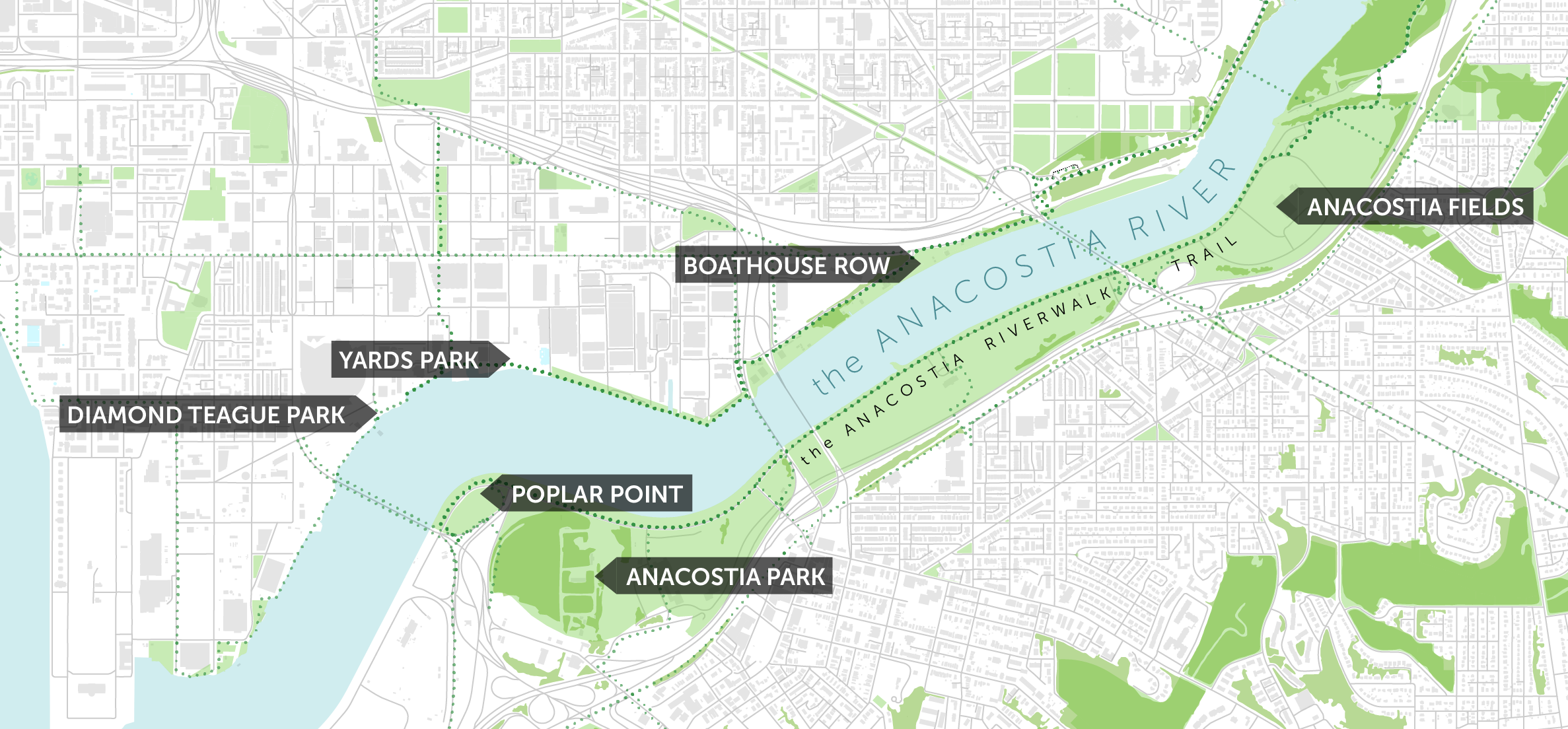
City Site Analysis Mapping
Custom GIS-based mapping with architecture, infrastructure, waterway, and ecological layers for proposed demo and redesing of RFK Stadium in Washington, D.C.
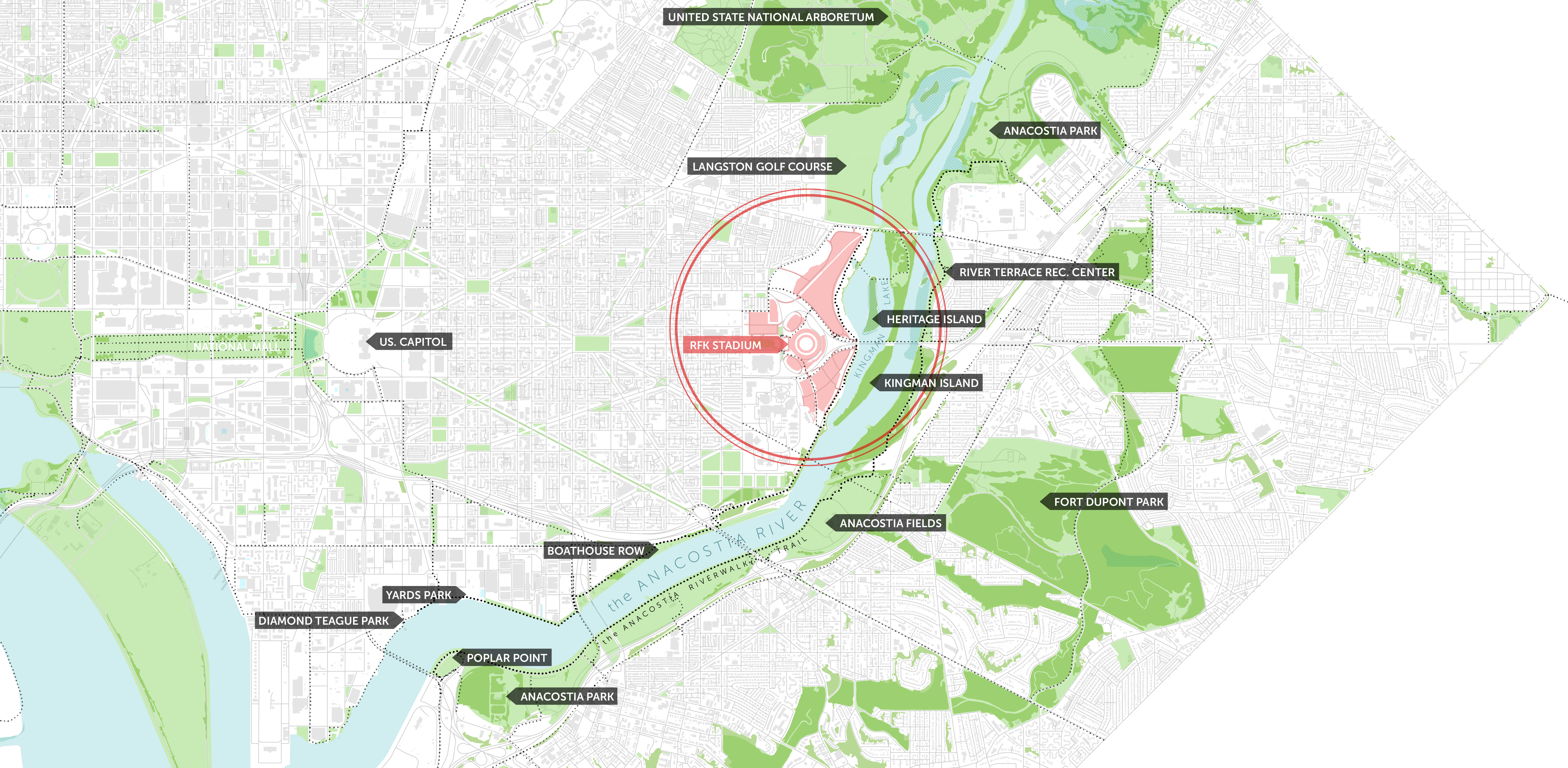
This large-scale map merges multiple spatial datasets—parks, waterways, marshlands, roadways, building footprints, and tree cover—into a unified visual narrative of the city’s ecological and infrastructural systems. Custom labeling and color design in Illustrator demonstrate cartographic composition and attention to usability at scale.